[Note: This is a VERY pic-heavy post so I apologize to those with slow Internet connections.]
I’m relatively familiar with Google Maps as it’s my favorite service for driving directions but I had no experience with Google Earth and began to wonder if it would be better in some way for prepping. So, I proceeded to download it here (it’s free) and installed the program. Now, I shouldn’t say that I have NO experience with it as my kids had installed it on another computer quite some time ago, I just never messed with it much until now.
Rather than talking about it, I figured the best way to compare Google Maps with Google Earth was via a comparison. So, I choose a nearby location that I knew fairly well in northland Kansas City, specifically I-29 and Barry Road for those who might know it, which happens to include a variety of businesses, including a popular outdoor mall, a variety of restaurants, a movie theatre, Walmart is nearby, and so on.
I started with a slightly zoomed-in view–you can see the zoom level on the left-hand side of the image where the little person is shown–using Google Maps of the area (click on image for a larger view):
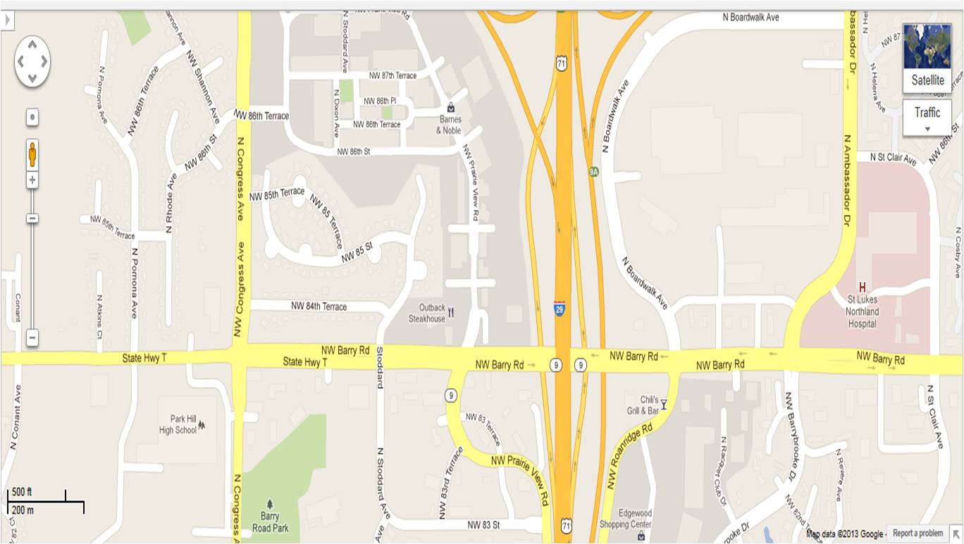
Upon first glance, I see major roads highlighted in yellow, highways in orange, smaller roads in white, and a few major locations such as the Saint Lukes hospital on the right of the image and the Barry Road Park in the lower left. Besides that, there isn’t much that I can use here. Of course, if I had viewed a different location, I might use a map like this to notice nearby woodlands, lakes, streams, etc but there aren’t any places like that around here.
I then decided to zoom in a bit and this is what showed (click on image for a larger view):
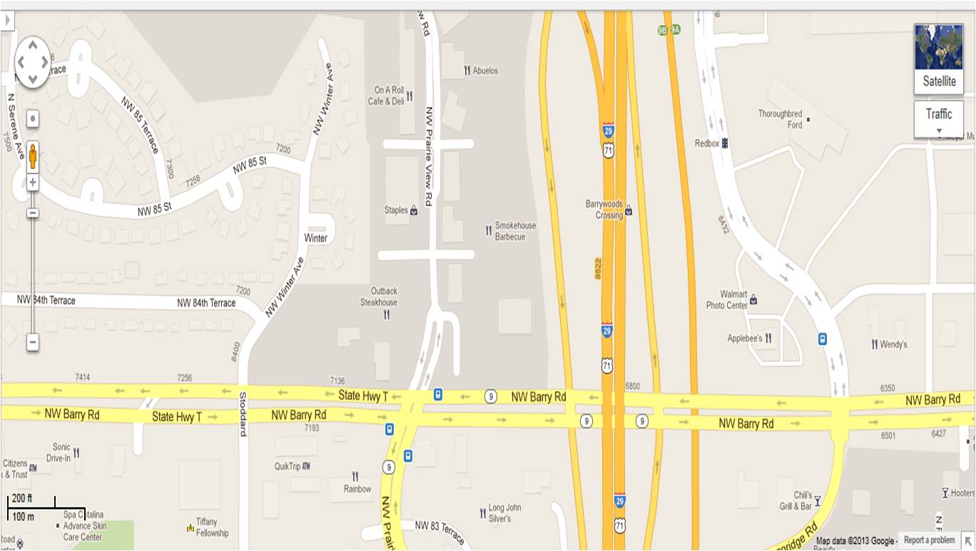
This view is slightly more useful in that I can now see some major businesses, such as Applebees, Chili’s, Outback Steakhouse (mostly restaurants) but not nearly as many businesses as there are in this location, so, I’m a bit perplexed as to what criteria Google uses to label businesses. Anyway, I figured that I needed to zoom in more (click on image for a larger view):
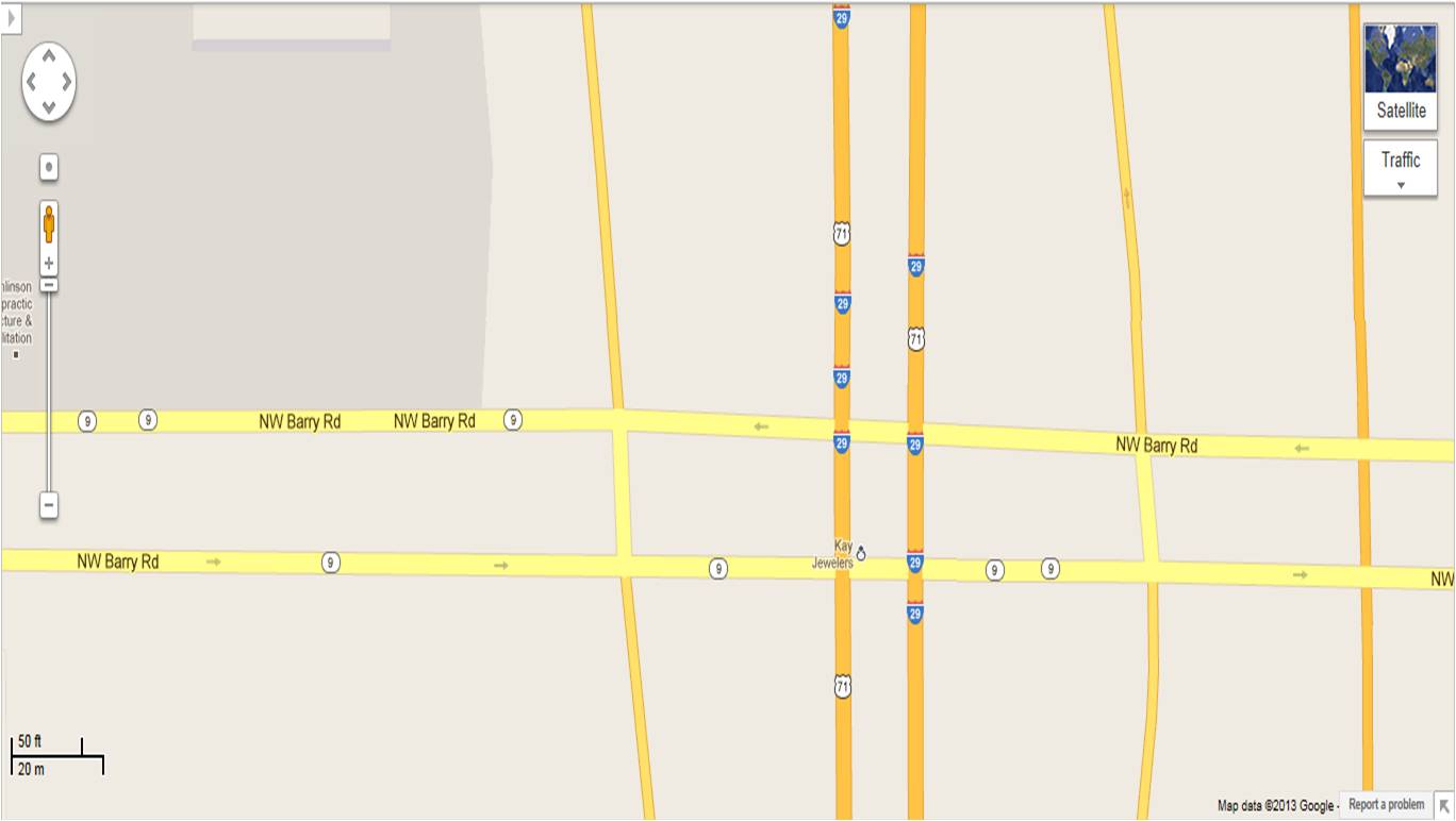
What happened? Where did everything go? I know I zoomed in as much as I could but I fully expected to see… something! I know full-well there are business right along Barry Road. Anyway, there appears to be an obvious “sweet spot” with the zoom feature to be aware of. In addition, Google Maps doesn’t show every business there is so be aware of that.
I should point out that there are some additional selections you may choose to to your Google Maps (e.g., Traffic, Video, Bicycling, etc) but I didn’t find any of these to be helpful in the moment, most of which didn’t seem to do anything.
So, I choose to move on to Google Earth hoping I would get more out of it…
There appears to be a whole lot you might be able to do with Google Earth but I didn’t bother to mess with it much other than to being zooming in (you see the entire earth for starters) until I got to the same general view of I-29 and Barry Road (click on image for a larger view):

I purposely left the layers pane (shown on the left) for you to see. As you can see the only selection I choose was to show the Roads. From the above image there isn’t much to write home about. So, I moved on and decided to select every option on the layers menu (click on image for a larger view):

I know it’s a bit hard to see (clicking for a larger image will help) but now I have a variety of icons to hover over, in particular, because of selecting the Places layer. Most of the other layers didn’t seem to do anything for this view, including the 3D Buildings, Ocean, Weather, Gallery, and Global Awareness layers. The More layer did add some stuff but I really didn’t see much purpose in it. For purposes of prepping it was really just the Roads and Places layers that seemed to show anything I found interesting.
I choose to zoom in a bit more and not only found better images of structures but of cars as well (click on image for a larger view):
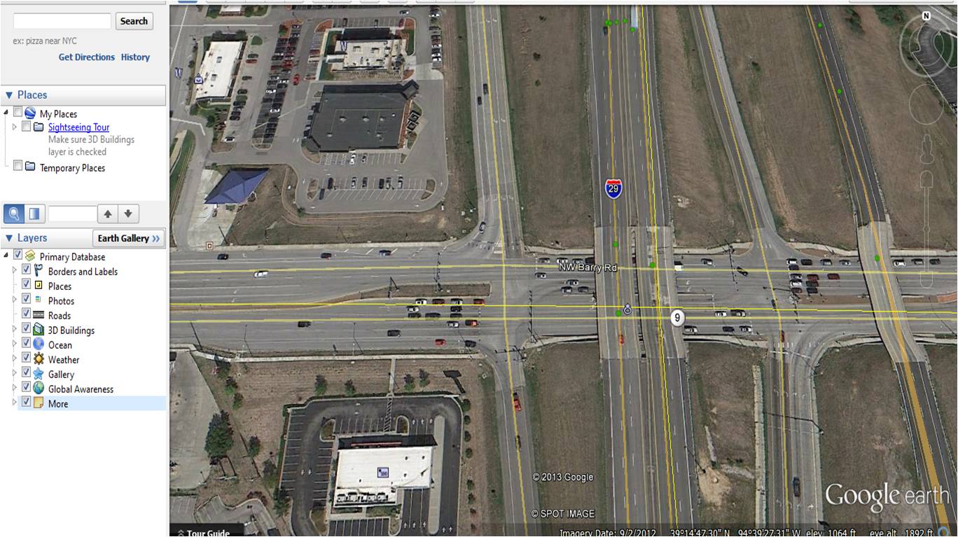
As you can see I kept all of the layers selected but it didn’t seem to do much good here. Again, there seems to be a sweet spot with regards to zoom… not too close, not too far… but just right.
Ultimately, the question is whether Google Maps or Google Earth is better or more useful for prepping or even if they’re useful at all?
I guess it starts with what your purpose is. If you simply want directions such as for a bug out route then obviously Google Maps is the way to go. In fact, Google Maps has some cool features such as the ability to select a walking or bicycling route, which attempts to avoid major highways or busy roadways. I’ve used that feature to plot on-foot bug outs to nearby locations with much success.
In addition, I can say that I would rather use Google Maps as an overview of any location I’m scouting out. I would rather print a Google Map and use that to mark on than a Google Earth image.
Is Google Earth, therefore, worthless?
Not quite. I can see a very strategic use for it, in fact. For example, here’s a view of a nearby lake using Google Maps:

As you might suspect, it leaves much to be desired as all I can see is the lake and nearby streets. Now, here’s roughly the same view of the lake but using Google Earth:
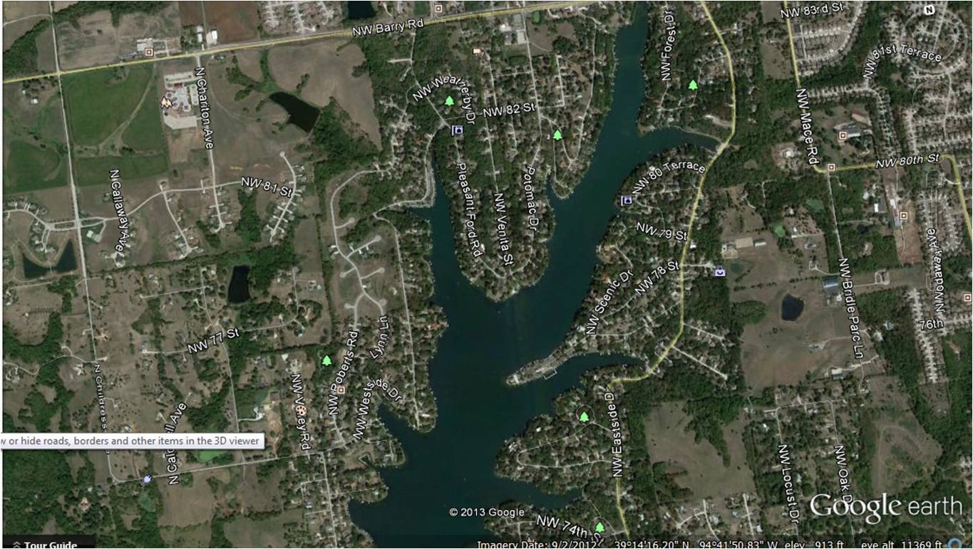
If you’ll notice from the above Google Earth map that you can begin to see layout and terrain, trees, etc, but not quite anything useful. So, I zoomed in a bit and even rotated the view so that instead of looking nearly straight down I’m looking at the lake from more of an angle:
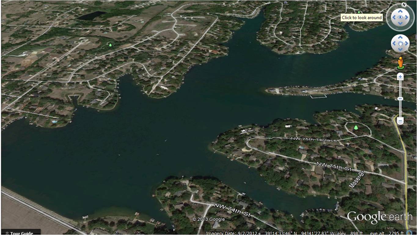
Now I’m starting to see contours. And, if I zoom in even more I get a better look at the terrain (the only problem being is that as I zoomed in more Google Earth wanted to straighten out my view):
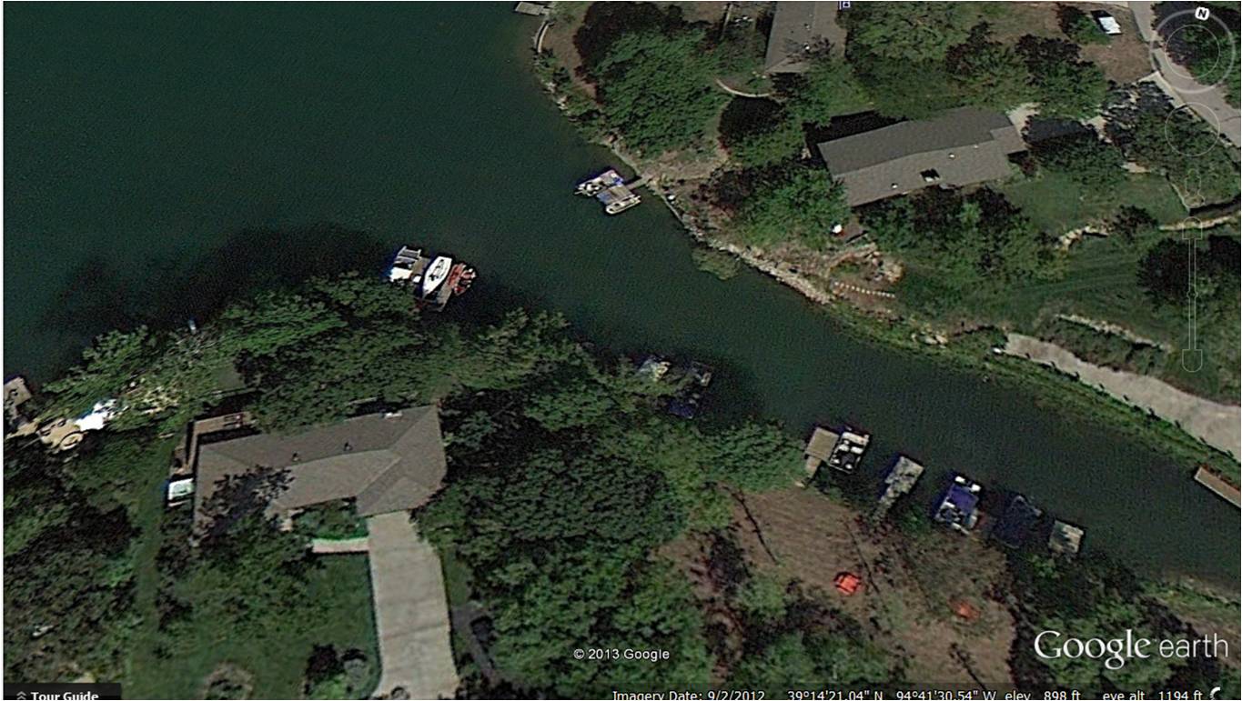
From this view I can see quite a bit. While I’m not going to demonstrate, you can actually use the controls to rotate around a particular spot 360 degrees. You have to do a bit of panning to continue to look at the same spot from different angles but it can certainly be done.
From the above image, I can see quite a bit. If this were where I lived I could use Google Earth to get different views of my area from a birds-eye view and see things I might otherwise have missed.
As such, I can foresee the use of Google Earth as a very good overview of the “battle front” if-you-will of any area you choose, the most likely being your own home and surrounding area. I won’t choose to show you my neighborhood, but if you look at yours you might get a very different view of the lay of the land, intersecting streets, nearby woodlands, and so on that might help you better defend your home, select unexpected bug out routes, find good spots to caches supplies, maybe even find unexpected resources that most people might not realize is there.
Try downloading Google Earth and play with it a bit. You might wind up with a useful prepping tool or, perhaps, just something to pass a few hours with.
Leave a Reply