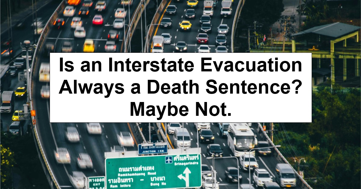
The question of whether to evacuate via interstate highways or “back roads” reared its ugly head again. But I’ve seen this debate play out in forums and Facebook groups from time to time. People line up on both sides, but most preppers say that evacuating via interstate amounts to little more than a death sentence. “Not so fast!” I say.
The interstate crowd (the few there are) points to speed and capacity. After all, you can cover serious distance quickly when traffic flows normally; the same cannot be said for “back roads.” But, then there is the congestion argument going against interstates, which are often already a mess even when things are normal. After all, if everyone heads for the highway when SHTF, you’re surely stuck in a parking lot and getting nowhere fast.
Both sides make valid points, but they also miss (or downplay) considerations, like assuming you’ll be evacuating in a vehicle on well-paved roads or that everyone else will be thinking or doing the same thing as you.
That’s not always how things work out. Let’s delve in.
The Mobility Problem Nobody Wants to Discuss
Here’s the uncomfortable reality: not everyone can walk ten miles with a backpack over hilly terrain and uneven ground. My mother-in-law, as a prime example, can barely get from the house to her vehicle without a lot of pain. There’s no way she’s going to be hiking anywhere. For us, it’s an evacuation by vehicle.
We, preppers, like to imagine ourselves hiking out of danger if we had to. The typical bug out fantasy involves shouldering a pack and heading into the woods never to be seen again. It makes for good survival fiction, but it’s not reality.
Real life includes elderly parents, infants, people with disabilities, chronic health conditions, and injuries. A sprained ankle quickly turns a three mile hike into a real problem. Add in bad weather and it’s an added disaster. Heart conditions, joint problems, and simple lack of fitness all matter when you’re talking about evacuation on foot.
This doesn’t mean you shouldn’t plan for walking; you should. But it does mean you need to be realistic about your actual capabilities and the capabilities of everyone in your family or group.
Because if you or anyone can’t honestly walk more than a mile or two, your entire evacuation strategy needs to account for that limitation. Thus, you really must prioritize vehicle reliability over other preps. For instance, that sedan which gets 40+ mpg might need to be traded in for a 4×4 that gets 15 mpg but can navigate off-road boulders. Or, at least, you might also want a 4×4 vehicle for this purpose.
Physical limitations also change which routes make sense. A railway bed might be flat and manageable for most of a walking trip, but a backwoods trail with elevation gains becomes unrealistic for all but the most fit among us.
The same logic can be applied to interstates and back roads. Although interstates get a bad wrap by most preppers (and for good reason at times), they’re also much wider, more navigable, and if you’re faster to the draw than most people, possibly not congested. County roads, even with wide shoulders, could become impassable if only a few vehicles get stuck in the same spot because many county roads (at least those I’m accustomed to) are lined with trees and ditches that most vehicles would never manage.
I’m not saying interstates are surely better or that county roads are bad, but I am saying that “it depends” on the situation, where you live, and where you’re heading. If that’s a town over, then maybe county roads are better; if it’s hundreds of miles away, then I wish you good luck and God speed on any non-interstate road … because you’re going to need it.
Alternative Transportation Worth Considering
Bicycles sit in a sweet spot between walking and driving. They don’t need fuel. They can navigate around stalled traffic. They let you cover serious distance without the physical demands of hiking with a heavy pack.
A decent bike costs less than most firearms. They require minimal maintenance, can carry cargo with the right setup (e.g., pull-behind trailers, baskets), and are nearly silent. Yet most preppers ignore bicycles completely. That might be a mistake.
Electric scooters and e-bikes offer another option, though they come with limitations, such as battery charging needs since you may not be able to recharge easily during a disaster scenario. But for shorter evacuations or getting to a vehicle you’ve staged elsewhere, they might be worth considering. Besides, I think they turn into a “normal” bicycle when they’re out of charge, so that’s a plus.
The key is matching transportation to your route, likely scenario, and capabilities. A bicycle may work fine on most back roads but could struggle on hiking trails; an e-scooter handles pavement fine but probably fails on gravel (I can’t say because I’ve only ever ridden one once in a big city.) Your physical condition, the distance you need to cover, and the terrain all factor in, too.
Remember Paper Maps When GPS Fails
GPS works great until it doesn’t. Honestly, sometimes it doesn’t work great even then. But, during a disaster, cell towers can go down, satellites might have problems, or your phone battery dies because you forgot to charge it. Suddenly that turn by turn navigation disappears and you’re screwed. Worse? It takes you directly into the path of thousands of unprepared folks trying to get out at the same time.
Thankfully, paper maps don’t need batteries. And they don’t depend on infrastructure, like GPS. But you need the right maps for your planned routes. While a standard road atlas shows interstates and highways just fine, it’s unlikely to show county roads and will be entirely useless for hiking trails.
Topographic maps show terrain features, elevation changes, and sometimes paths that don’t appear on road maps. USGS topo maps are available for every part of the country, too, from what I’ve gathered. Plus, they’re not expensive. You can order them online or sometimes find them at outdoor stores. (I also recommend you get them on your smartphone as an app, along with dozens of others.)
Trail maps for state and national forests should show established hiking routes. Railway maps exist (though they’re harder to find). County plat maps should show property lines, rural roads, and features that don’t make it onto standard maps but I haven’t much experience with these. (Search for your county and state and “plat map” and you’ll probably find what you need online.)
Here’s the thing about some maps: you need to know how to read them before an emergency. Trying to figure out contour lines and map scales while you’re stressed and running low on daylight is a recipe for a disaster on top of a disaster!
Practice with your maps now. Take them out and ask your family to read them. Use paper maps to plan routes, assuming you’re doing so legally and safely. Learn what the symbols mean and how to orient them to the terrain around you because it’s not always intuitive.
Also, keep them in your vehicle or bug out bag; that’s what we do. After all, a fancy map sitting on your bookshelf at home doesn’t help you when you’re stuck on the interstate fifty miles away or you had to grab your bug out bag at the last second.
Thinking Beyond Pavement
Most evacuation planning focuses exclusively on roads be they well-paved interstates or mostly maintained county highways, even if they’re only gravel. People mostly plan their routes on Google Maps or Waze (my preference), looking for the fastest path from point A to point B and little more.
The problem is that everyone else does the same thing. And when a real emergency hits, the main roads become the most congested, most obvious, most predictable routes available. (Honestly, I doubt any GPS knows to navigate “back roads” half the time without constant rerouting.)
I’m not saying avoid traditional roads completely because there are clear benefits to using them. I am saying, however, don’t limit yourself to only thinking about “traditional” roads when travel looks impossible. (Here’s an older video about developing alternate bug out routes that goes deeper into the topic if you’re interested.)
Railroad tracks and utility corridors, as an example, cut through terrain that roads go around. They’re not designed for vehicle traffic, which means they’re largely ignored during evacuations. A bicycle or even someone on foot can follow a railway line for miles without encountering traffic. Granted, it’s not ideal, but if you’re desperate, then you do what you gotta do. Right? (There’s also the safety concerns of choosing railroads as they’re not intended for anything besides trains. So, just be aware of your surroundings and know where you might be able to bail should a train force you to.)
Hiking trails and ridge lines offer another option. If you’re in mountainous or heavily wooded terrain, established trails can get you around bottlenecks, albeit with a significant amount of effort. Ridge lines give you visibility and often connect to fire roads or service paths in many areas. These routes require more physical effort, but they might be your only option when roads are blocked. Best of all, most people wouldn’t consider them.
Waterways might be viable in some regions. Rivers, canals, and coastlines provide natural pathways to a degree. A small boat or kayak stored at home or a friend’s place could be worth more than a tank of gas in certain scenarios. But, then, even this isn’t ideal considering just how difficult many smaller waterways could be to navigate. Still, it’s a potential option should worse come to worst.
And while various maps exist that could help you navigate these routes, you just can’t beat scouting them yourself, before you need them. But, as with all off the beaten path suggestions, there are plenty of potential safety and legal considerations, so I can’t directly recommend you do that, either.
Although it’s wise to know of such alternatives, you’re probably stuck with the primary routes (interstates and back roads) as the two primary choices in all but the most serious “end of the world” scenarios.
Multiple Plans for Multiple Scenarios
The interstate versus county road debate, like many, assumes a single “best” answer exists.
It doesn’t.
Different scenarios / timing / capabilities call for different options. A wildfire might make back roads the only option as highways get closed. A hurricane evacuation might favor interstates since you’re leaving with everyone else anyway. A grid down scenario could make any evacuation a bad choice. Who knows.
You need multiple plans based on multiple scenarios, including primary, secondary, and tertiary routes. You might want/need different transportation options, like bicycles or e-scooters. And you’ll want maps for all of them. Again, they’re usually not expensive and should be useful for years to come.
If possible, scout routes when you can, even if it’s only using Google Earth to get a lay of the land. Note where gas stations are (and aren’t). Find water sources should the journey be a lengthy one. Identify potential camping spots or places to shelter while you’re at it.
Understand that the time to discover that your alternate route includes a washed out bridge or a 5000-foot elevation gain is before you have no other choice.
To be clear, don’t get locked into the thinking there is “only one way to do it.” Don’t assume you’ll be in a vehicle. Don’t count on technology working. Don’t assume you (and everyone in your group) will be capable of covering large distances on foot uninjured. Plan for multiple scenarios, multiple routes, and multiple transportation methods as much as is feasible.
And don’t discard interstate evacuations as always a bad choice because, as with almost everything related to prepping, “it depends.”
Leave a Reply