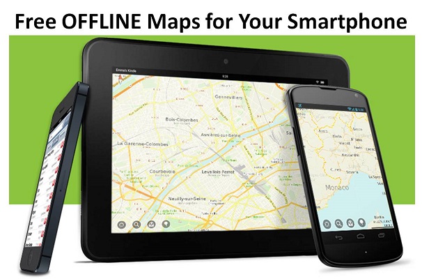
I can’t remember now where I found out about maps.me but it had to be another survival blog. Anyway, I’ve since decided to fiddle with it some more and began to make good use of the app for my smartphone by adding dozens of offline maps. While I use the iPhone Maps.me app there are apparently similar apps designed for Android from Google Play, Kindle from Amazon, Samsung Galaxy, and more if you only search for it.
I should point out that I’ve linked to the “Lite” or free version above. There is a pro version which is $4.99 (at least for the iPhone) and they’re always trying to get you to upgrade with benefits being mostly stuff I don’t care about from a prepping perspective, such as bookmarks, sharing, and other stuff that I wouldn’t want it to do in the first place! But if you can get past the occasional “upgrade” info including the “go pro” button on the map screen, Maps.me is well worth the time and effort to download.
I should point out that I first choose to download this app to my iPhone and began to download offline maps for my home state of Washington as well as neighboring states and then wound up downloading them for the Midwest for when we go back to visit family and a few other states. I wound up downloading about 17 states and used 1.2 GB of storage which is more than I would have preferred but felt it was worth the potential tradeoff from other apps.
I was, however, curious as to how much space the entire United States would take up so I downloaded the app to my iPad and after about a hour of constant downloading found that it totaled 2.4 GB. Most states range between 40-60 MB or so with some really small maps for Rhode Island and Delaware and very large maps (200 MB+) for California and one or two other maps I downloaded.
I also choose to download offline maps for British Columbia, Canada because we’re close enough to the border that I might have to head that way. With that in mind, I should mention that you can download maps for Canada and Mexico as well as plenty of other areas, including Europe, South America, Asia, Africa, and other places. If you travel to far-away destinations this might prove useful to have as a backup.
Speaking of which, I’m not at all suggesting this should be your primary map means whatsoever! Obviously, you’re limited to viewing what you can on the size of small cell phone screen and so it can be hard to understand precisely what you’re looking at and there is plenty of scrolling involved especially if you’re zoomed well into a map. This is no different than any other map applications, including Google Maps.
But, as a backup and always with you option–assuming your cell phone is on your person when you need it–if you can spare the space and 20 minutes you can easily have offline maps on your cell phone for your home state and neighboring states too. Do this for anyone else in the family who has a smartphone and now everyone will have one more layer of redundancy.
Choose to add in states that you may visit frequently for business or pleasure and even delete them later if you need the space. Granted, one or two GB of data honestly isn’t that much for most smartphones these days. Do yourself a favor, download the Maps.me offline maps app and add a few states, then stash it away on your phone in case you ever need it… you may be thankful you did.


Leave a Reply